Friday 8 October 2010

Ama Dablam expedition

Ama Dablam from Dingboche on the Everest trail

I'm currently flying out to Kathmandu to lead the Adventure Peaks 2010 Ama Dablam expedition. This stunning mountain is situated just south of Everest and offers one of the most technical climbs that is regularly commercially led. You can follow our progress on the Adventure Peaks news pages and I'll have a full report here on my return.

Thursday 7 October 2010

Langdale Recce

Scafell Pike & Scafell from Bowfell's Three Tarns

On an absolutely stunning day of blue skies and light winds we drove up to the ODG to recce some of the route for the Langdale fell race which takes place this Saturday. Temperatures were perfect for running and we made good time up to Stickle Tarn and on to Thunacar Knott. The descent to Stake Pass is extremely boggy after the recent rain with one pool nearly waist deep! We cut the corner at Esk Hause and were soon on the summit of Bowfell which offered some stunning views. We opted to descend back to the valley floor via the Band to save the legs and to enable some rehydration in the Stickle Barn.

Wednesday 6 October 2010

Outward Bound

Canoe sailing down Ullswater

I've spent the last three days working for Outward Bound Ullswater on a personal development course for young people. We've used gorge scrambling, trapeze, canoe sailing and improvised rafting to give them an enjoyable adventure but also to help build their confidence, friendships and a level of respect among their peers. The group have all just started at senior school together and we hope the challenges this week will have given them a real insight into themselves and help with this transition.

Sunday 3 October 2010

Ama Dablam Expedition

Ama Dablam under the first snows of winter.

This coming weekend I fly out to Kathmandu to lead an expedition to Ama Dablam (6812m), one of the worlds most beautiful mountains. This is a trip for Adventure Peaks and regular updates on our progress will be posted on their website. Summitpost has some great photos of the mountain here.

The following video from Philippe Gatta shows a pre-monsoon ascent from earlier this year and gives a good illustration of the climb.

More Advanced Navigation

Using slope aspect to relocate in poor visibility.

Today was the second of a two day Advanced Navigation course for Mountainsplus. With plenty of low cloud around we opted to drive up to the Three Shire Stone and use the area around Cold Pike to challenge and develop various navigational strategies. The morning was spent looking at using time to measure distance and compare the merits of Naismith and Cliff! We also developed a default strategy to guarantee the navigation was accurate as possible for a worst case scenario.
After a quick bite to eat we played with searching for your target in poor visibility and worked through how to relocate when you are temporarily misplaced (lost!). The rest of the day was spent looking at the various navigational strategies that we could use on some pretty tricky legs.
We had a few brief showers but the winds were very light and there was even a few bursts of sunshine towards the end of the day. Overall a very successful course and everyone has gone away with plenty of tools to practice and experiment with.

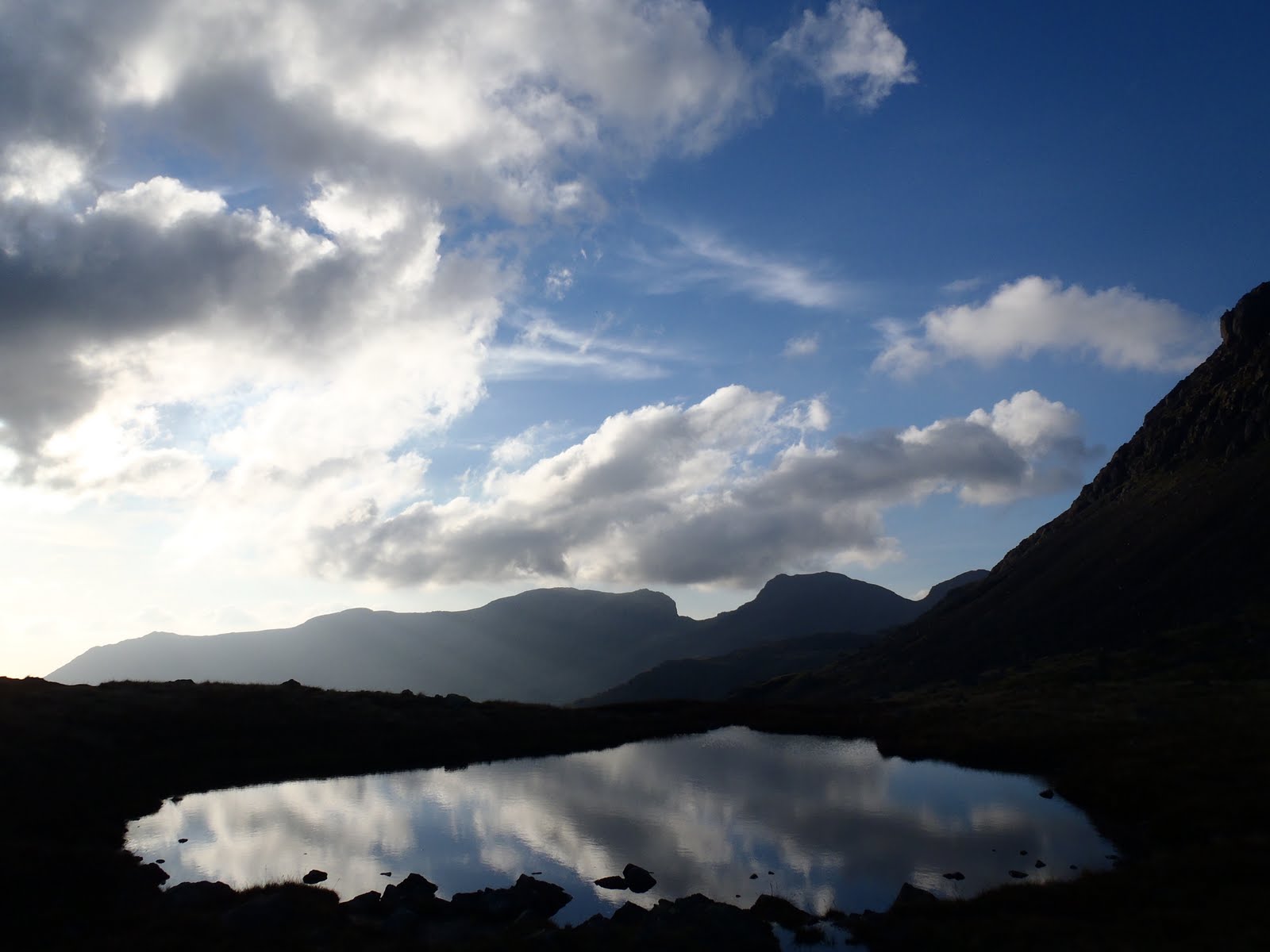
Low lying cloud around the Langdale Pikes
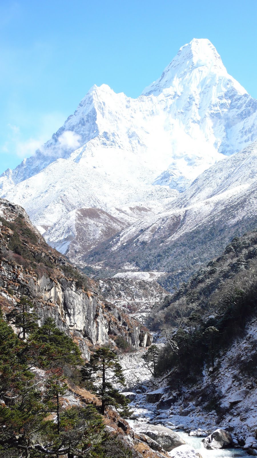
Saturday 2 October 2010

Advanced Navigation

Peter steady on a bearing

Today I've been working for Mountainsplus on an Advanced Navigation course. After all the rain and low cloud in the past week we were greeted with perfect visibility today, just when we wanted it to be a bit more challenging! From Elterwater we headed up towards Silver How and spent the morning looking at contour recognition and using them for navigation. After lunch we added in the compass and completed a number of exercises involving bearings, pacing and boxing around obstacles. A good solid foundation on which to build navigation strategies tomorrow.